
We’ve all been pretty grounded lately and sticking to local areas, but in the largest state in the US (Texas can fit in Alaska 2.5 times), “staying local” is really a misnomer!
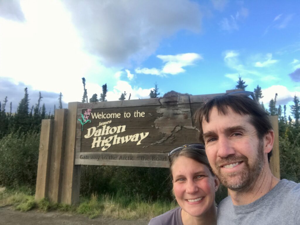
So when Justin & I were coming up with a mini-trip to put in the books for this summer, we opted to drive all the way up the Dalton Highway to the farthest north you can drive in Alaska.
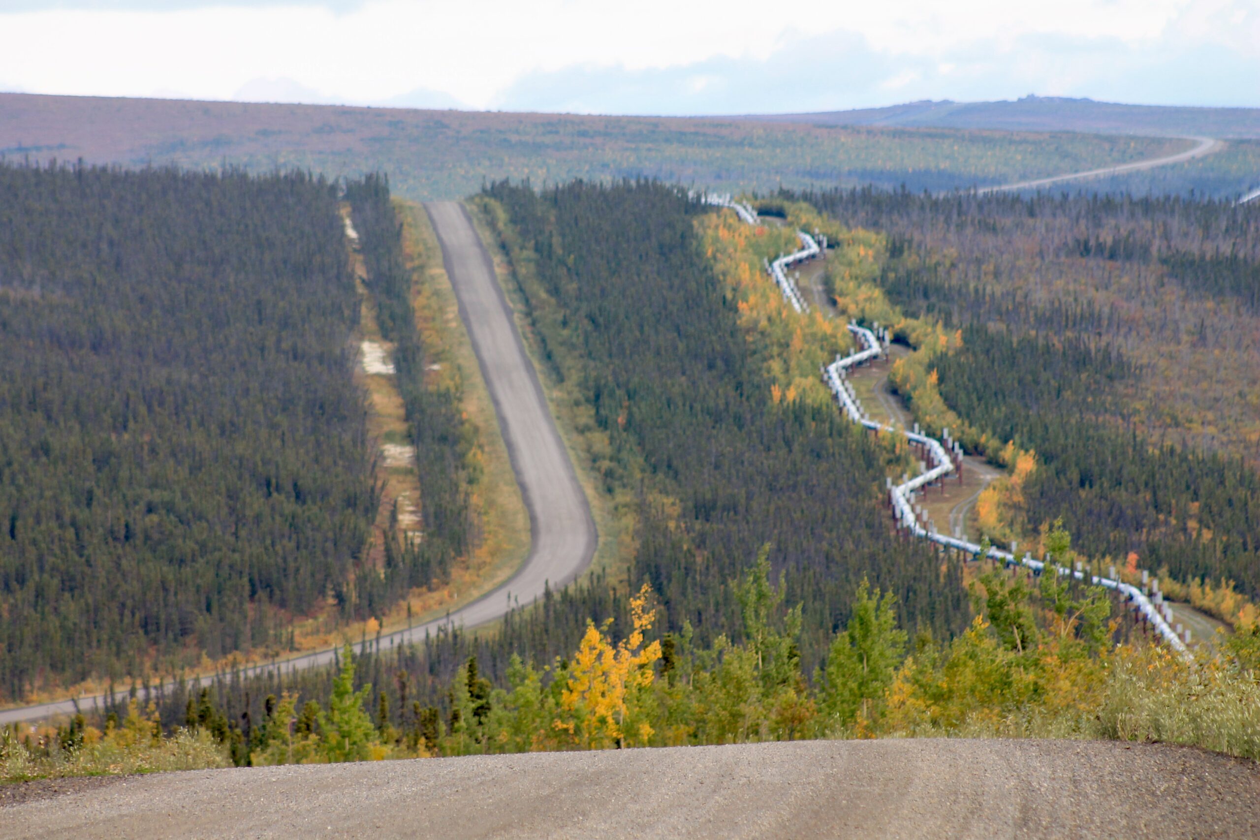
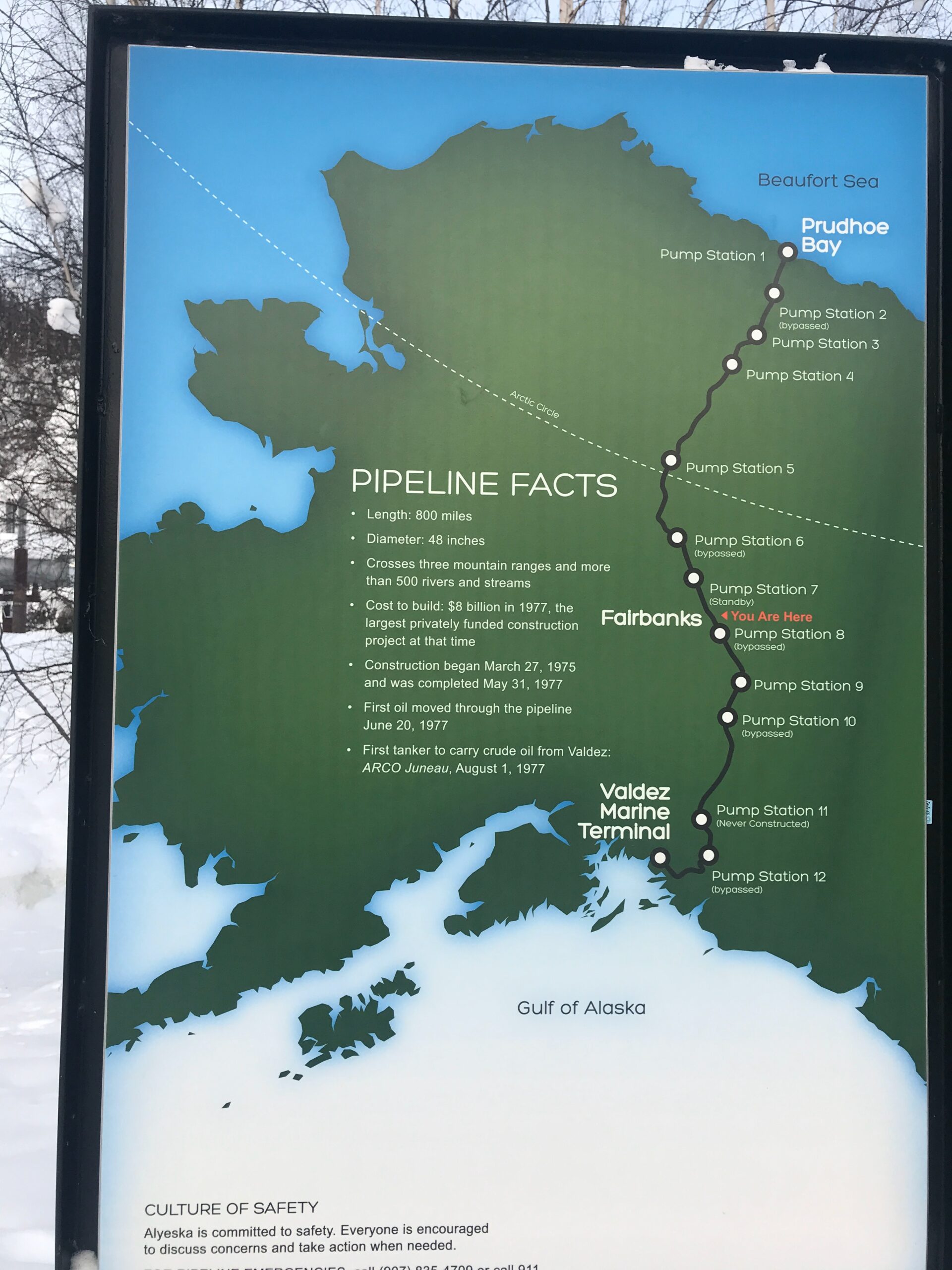
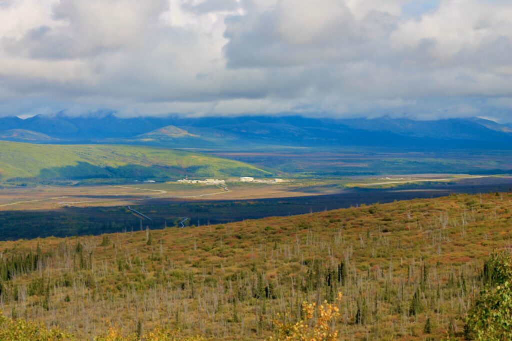
The Dalton Highway follows the Trans-Alaska Pipeline and ends at Deadhorse/Prudoe Bay, where the oil comes from. Its whole purpose has been to service the oil transportation system, known as “the pipeline.”
So first, a little pipeline info and background …
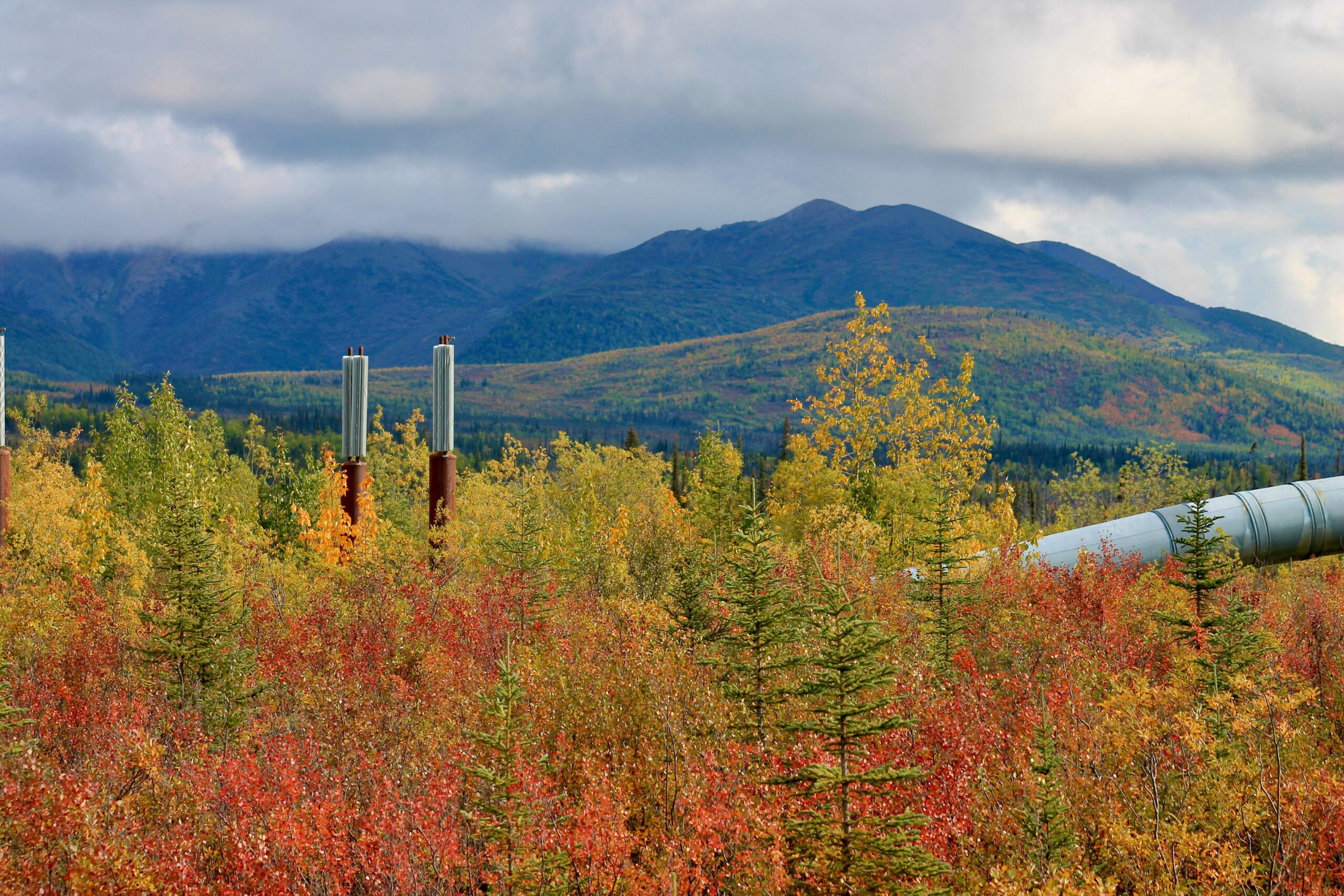
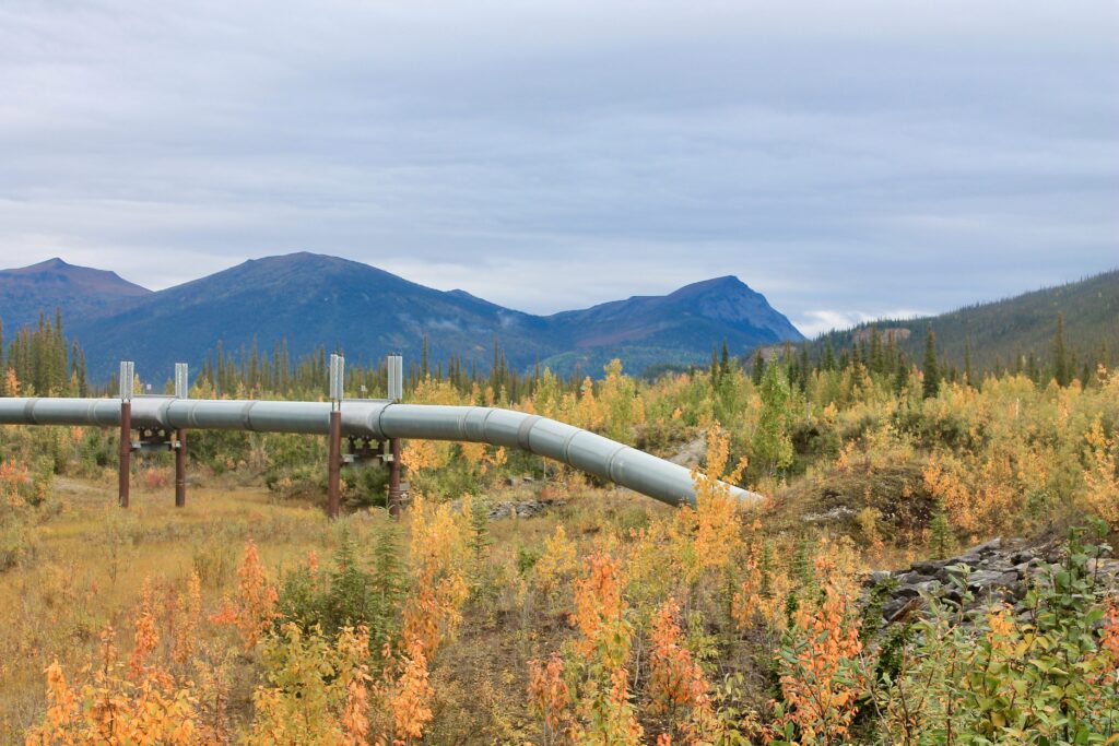
The Alaska Pipeline was built in the 1970s in order to carry crude oil 800 miles from deep in the ground at Prudoe Bay to Valdez Marine Terminal in southern Alaska. It’s an engineering marvel. The 48-diameter pipe crosses 3 mountain ranges (Brooks, Alaska & Chugach) and 800 rivers and streams (34 being major). Because the oil can be warm (over 100 degrees), it couldn’t be buried like typical pipelines around the world because it would thaw Alaska’s permafrost soil, thus creating unstable ground. So it was buried in areas without permafrost, but elevated in the permafrost areas. (I know my sister will ask, so permafrost = permanently frozen ground that lies beneath much of northern Alaska and keeps water close to the surface).
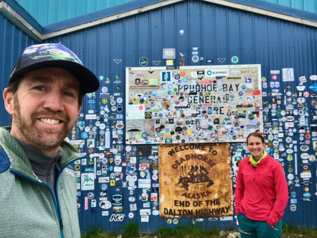
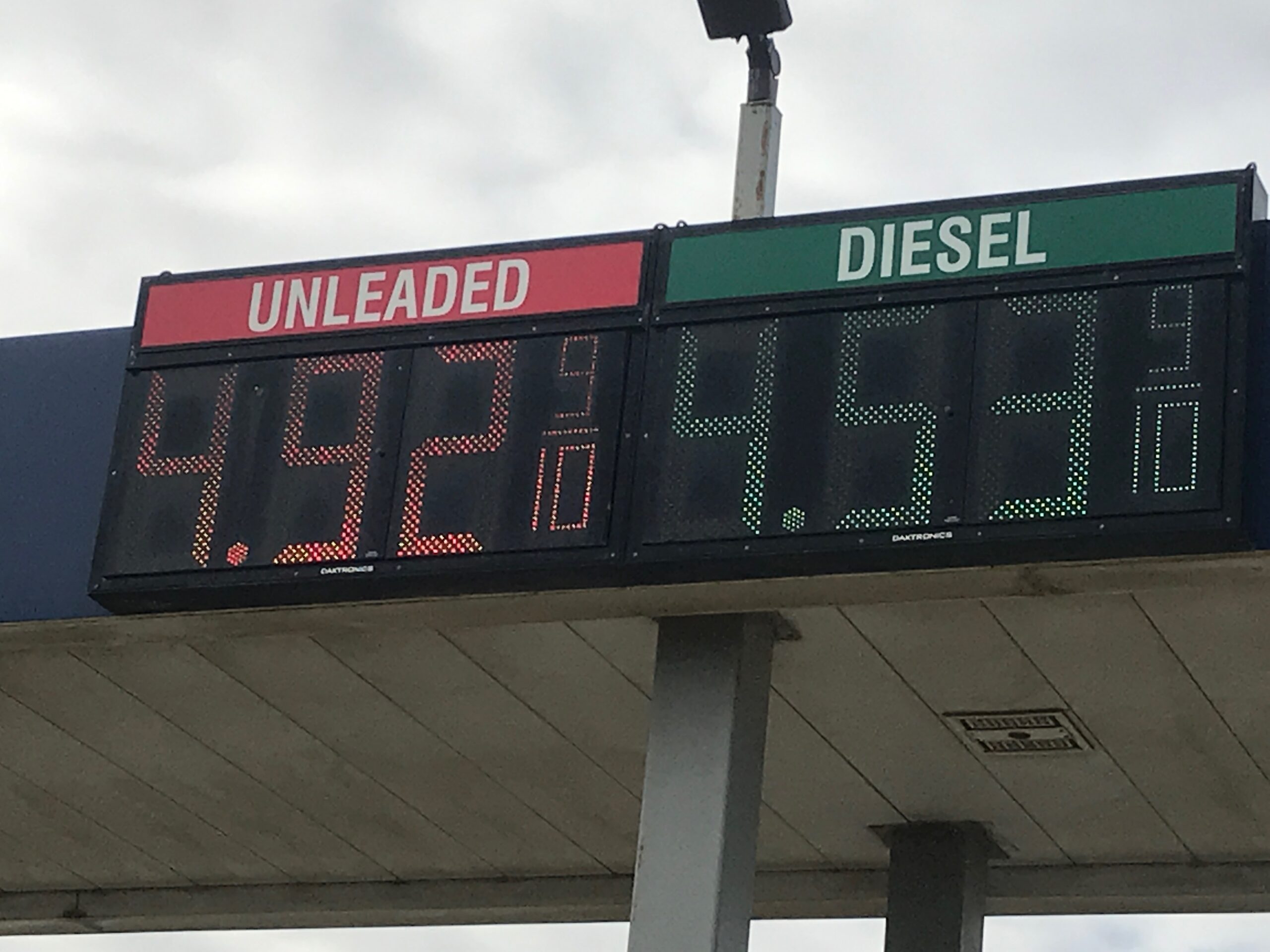
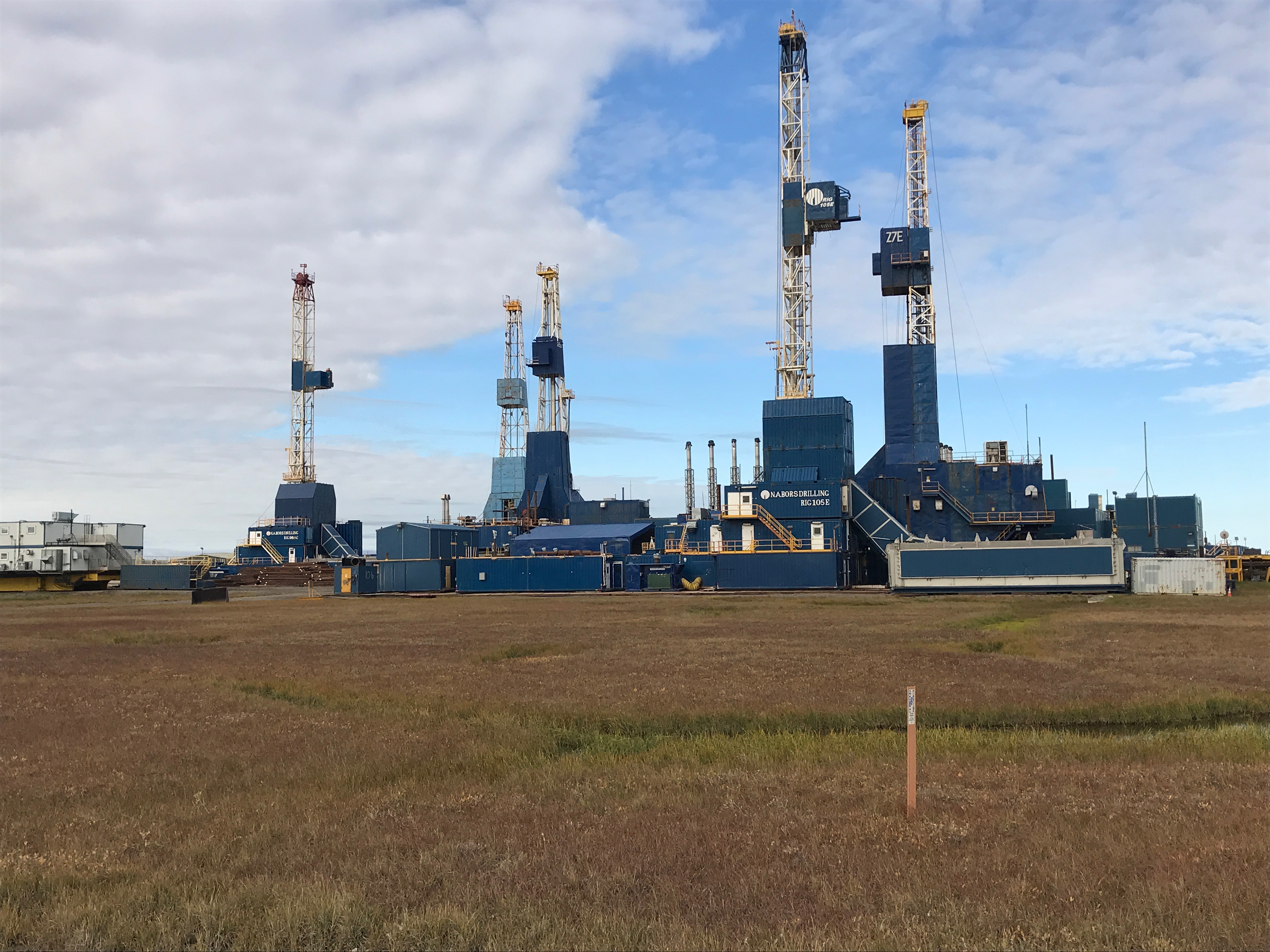
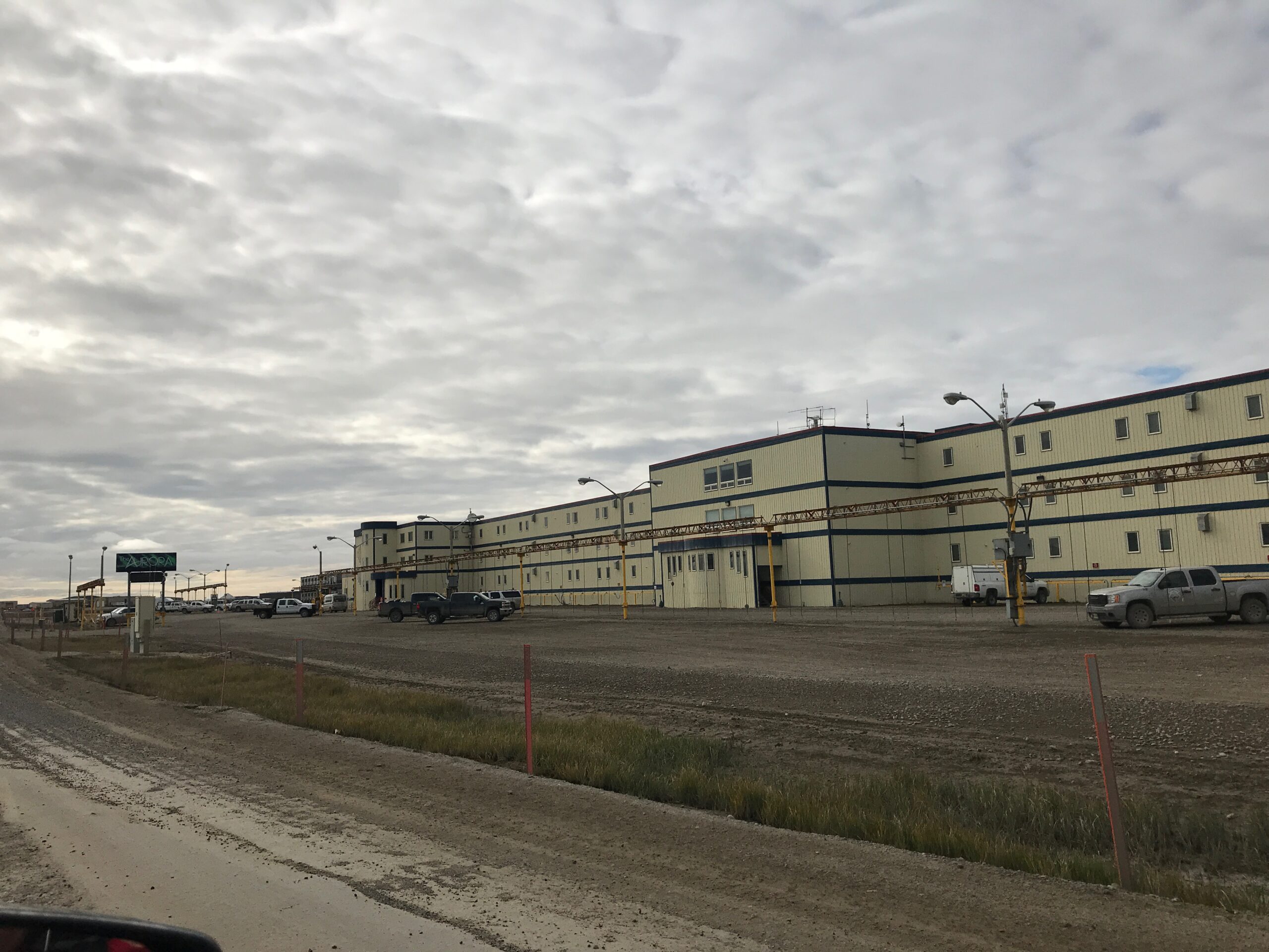
Many of our Alaska friends questioned our sanity when we said we were driving up to Deadhorse/Prudoe Bay. “Of all the beautiful places you can go in Alaska…” From Healy, it is about 1200 miles roundtrip to Deadhorse/Prudoe Bay, and there is literally nothing to do in the “town.” In fact, there’s nothing but modular trailers and oil rigs since it serves as an industrial camp. The population of 2,000 people includes mostly oil crews for drilling, construction, maintenance and transportation. Under normal circumstances, you can take a tour of the oil fields and jump into the Arctic Ocean, but those tours are on hold due to Covid. So we literally filled up on $4.92/gallon gas and turned back around to drive south.
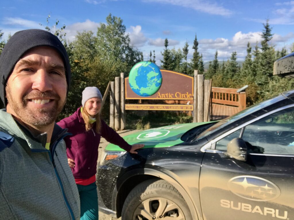
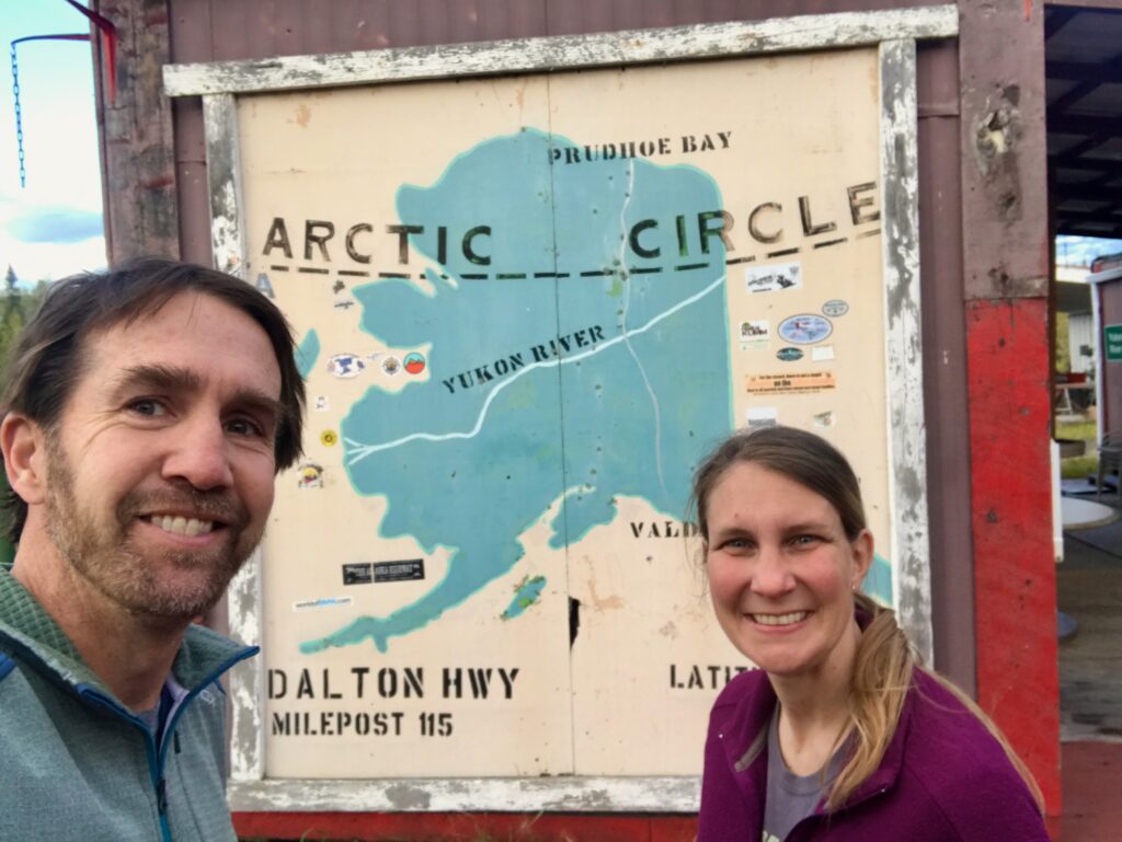
But here’s the thing, why not drive aimlessly to the far-reaching northern part of the Arctic Circle? There are only 14,336 miles of public roads in all of Alaska, which is about the same amount found in Delaware, the smallest state (and in comparison, Texas has nearly 680,000 miles of public roads). The Dalton Highway to Deadhorse/Prudoe Bay only opened to the public in 1995.
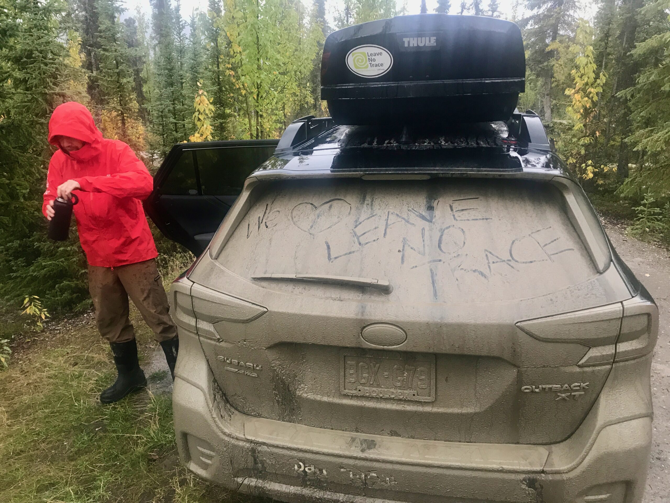
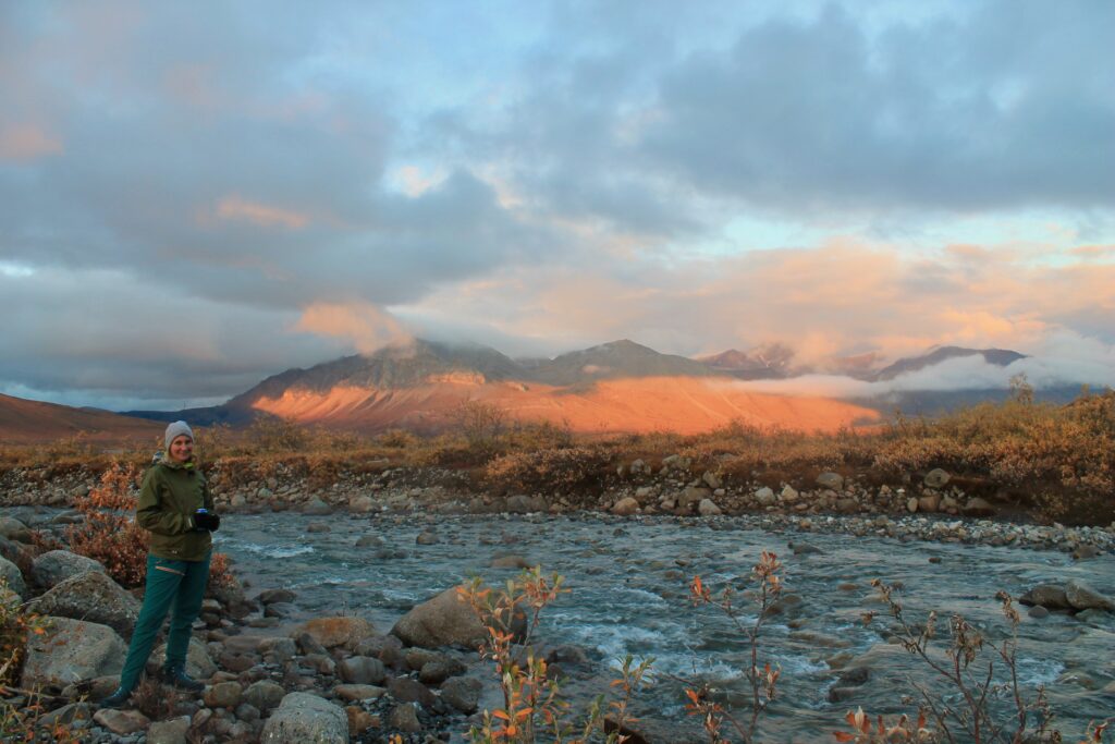
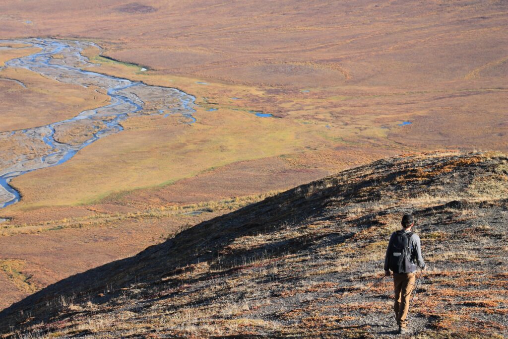
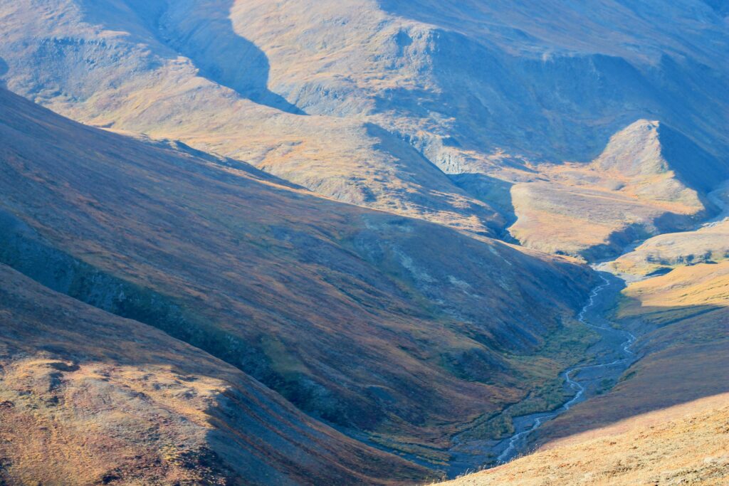
It’s the journey along the Dalton Highway that makes the trip. It was originally known as the “North Slope Haul Road,” due to the fact it serves as an access road for trucks driving supplies to and from Alaska’s oil field in Deadhorse/Prudoe Bay. I’m sure most of of you have heard of the reality TV show “Ice Road Truckers” … the Dalton Highway stars in that show. Though it is not an ice road this time of year, most of it is unpaved, which means mud, dust and gravel. The road is notoriously curvy and narrow with no shoulders or guardrails. Both northbound and southbound, we passed more trucks than cars (about 50 trucks each way), so the truckers definitely still have a monopoly. There is no cell service and pretty much no services along the way, so you need to be very prepared to fend for yourself. And once you get about halfway to Deadhorse/Prudoe Bay, the scenery of alpine tundra does become a little redundant.
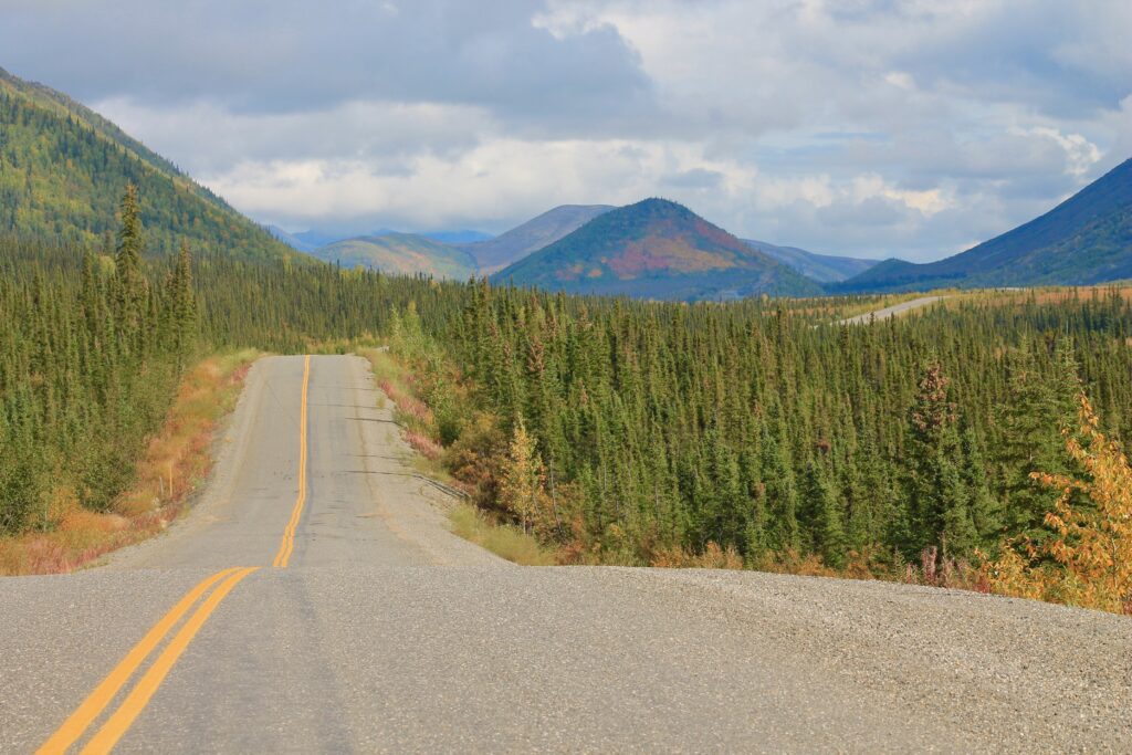
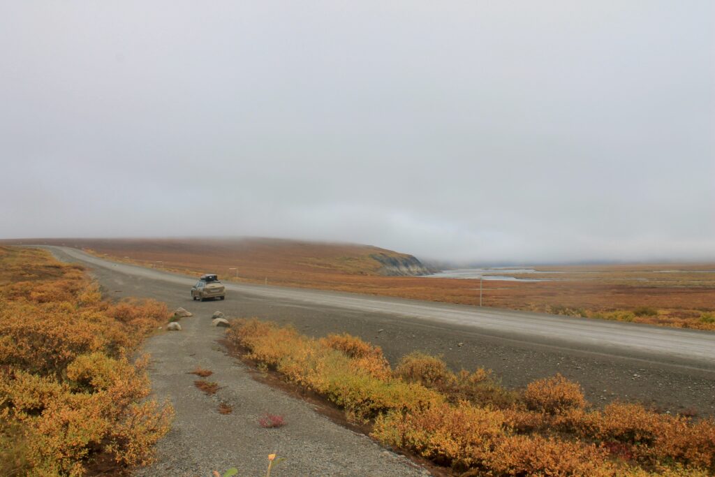
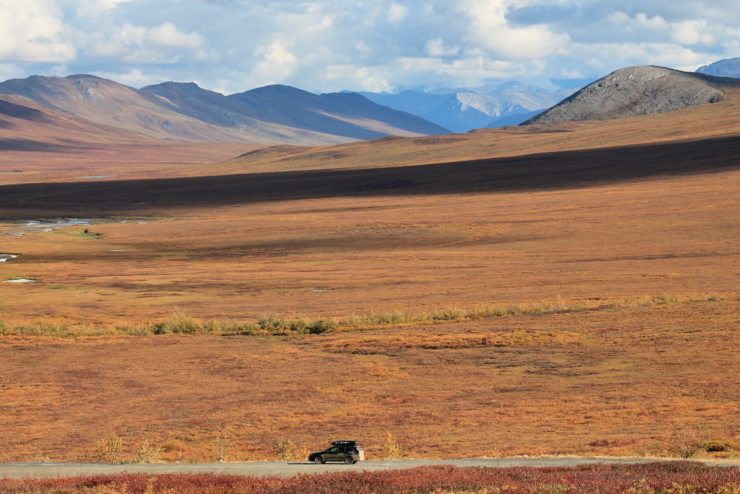
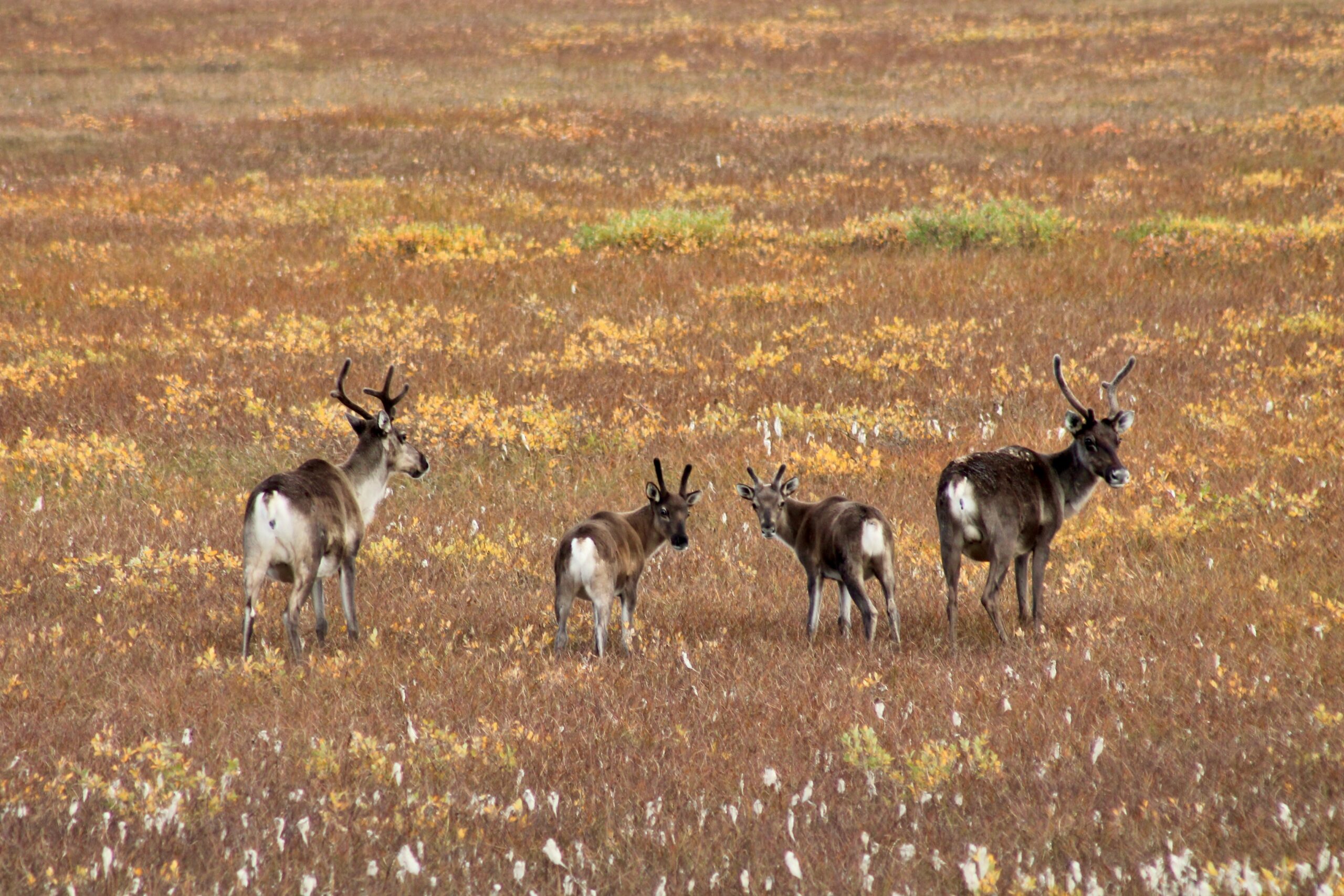
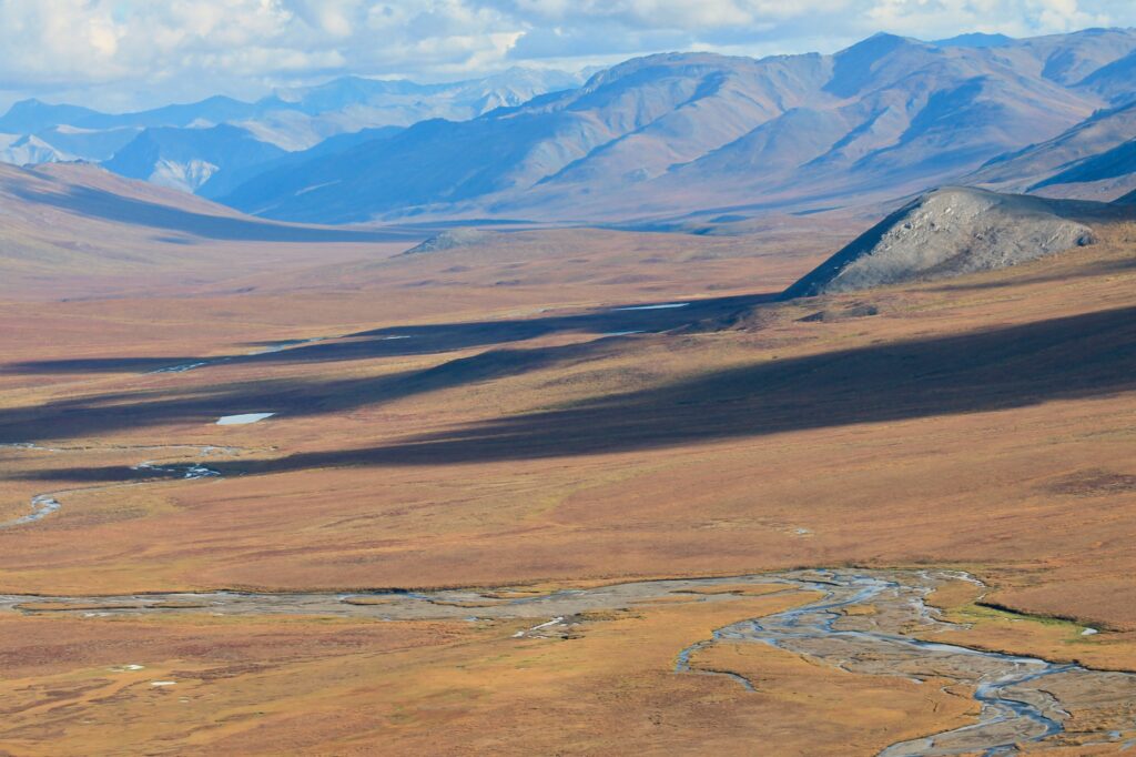
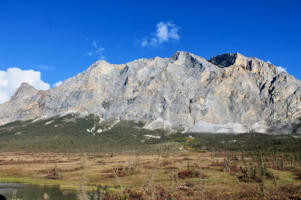
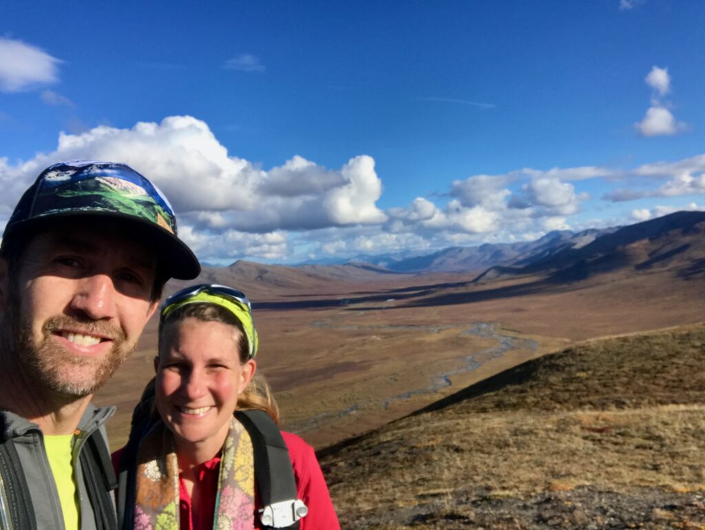
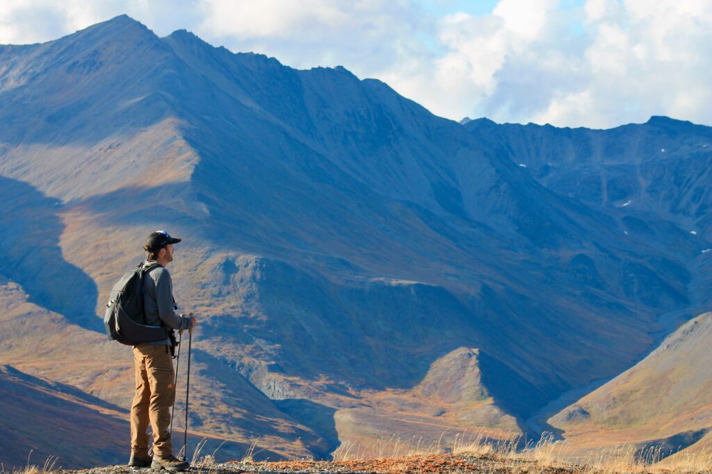
As you can see, the fall colors were in full swing in the Arctic Circle. So much of Alaska is wild and extreme, and this territory was no exception. It changes from boreal forest to tundra to Arctic coastal plain. The Brooks Range might not have as high of mountains as the Alaska Range where we live, but it was drool-worthy. We camped along the way at some gorgeous spots.
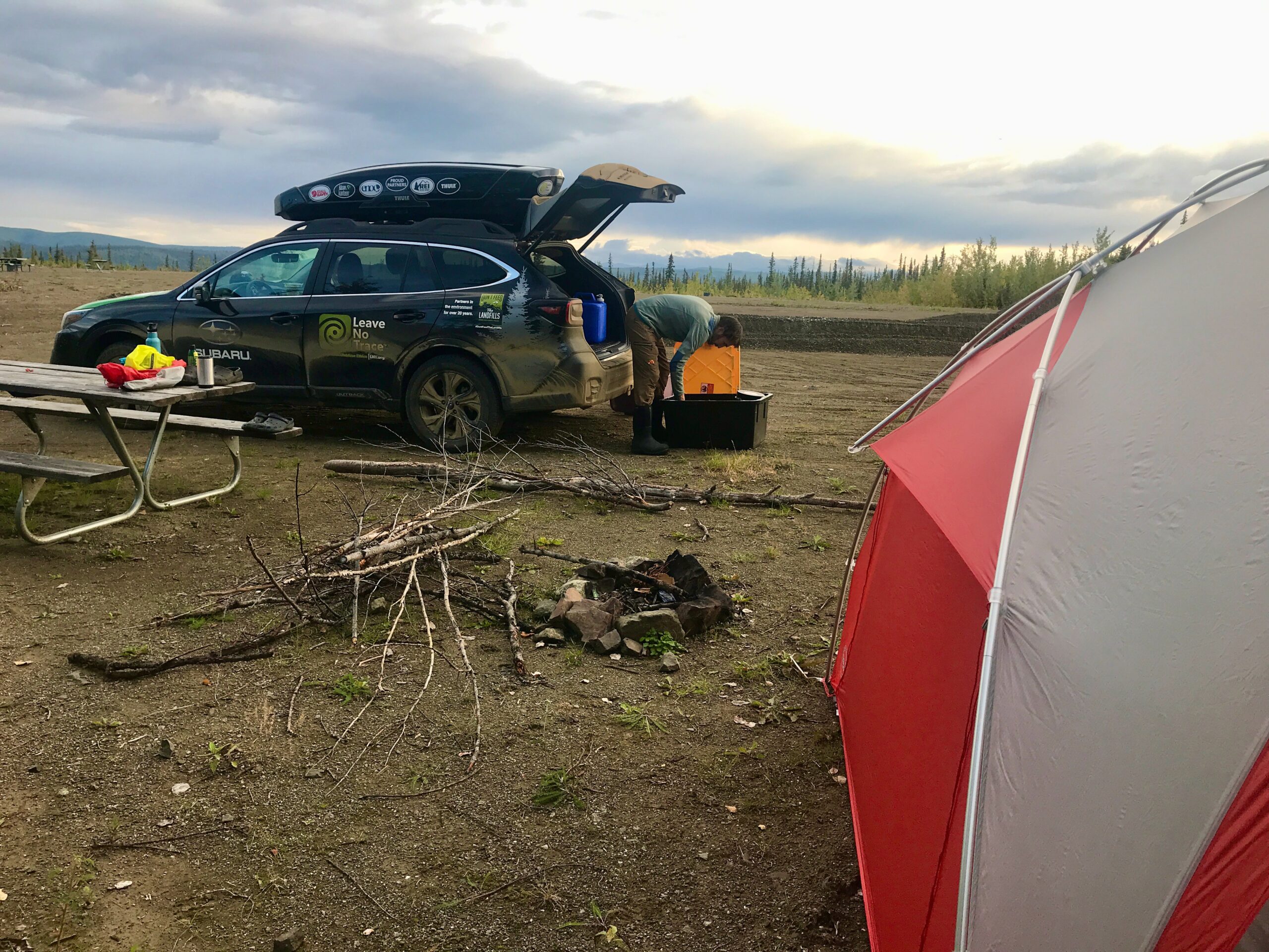
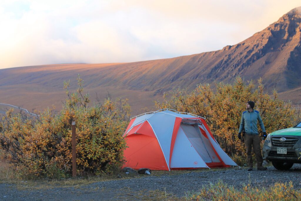
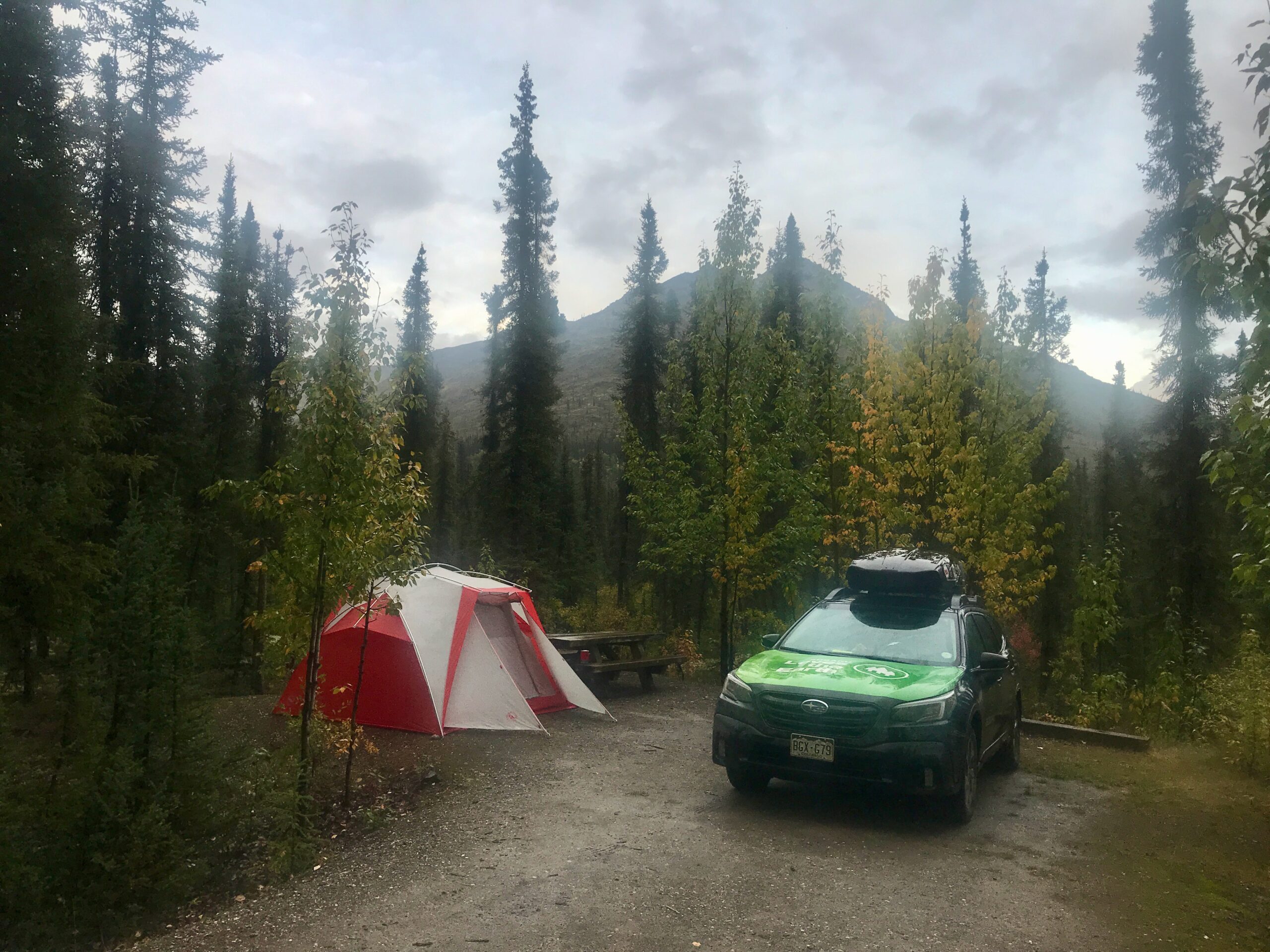
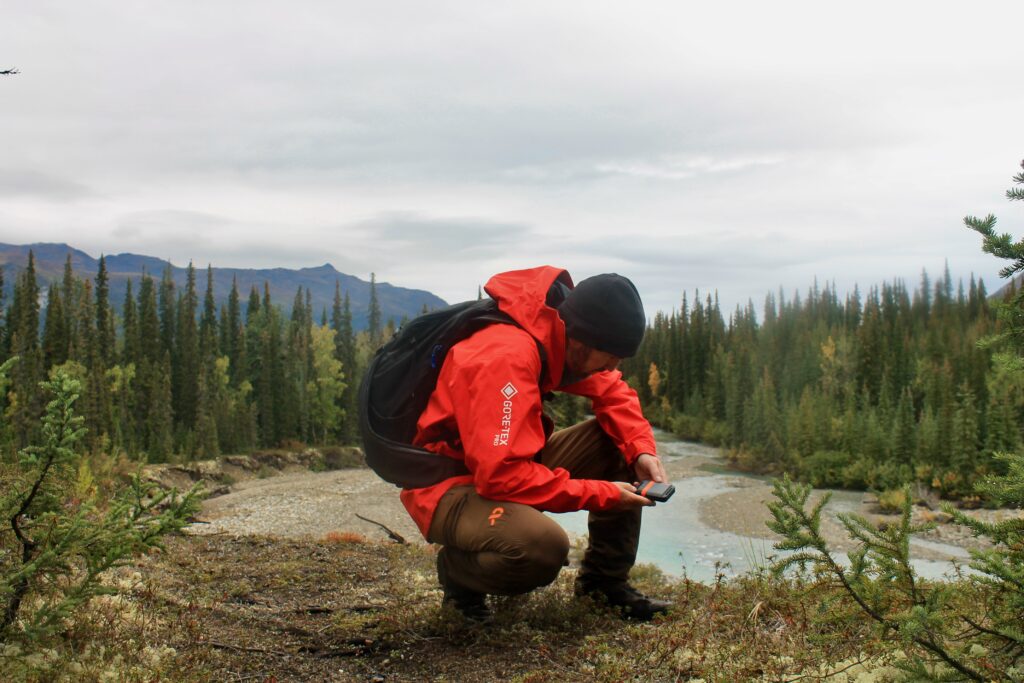
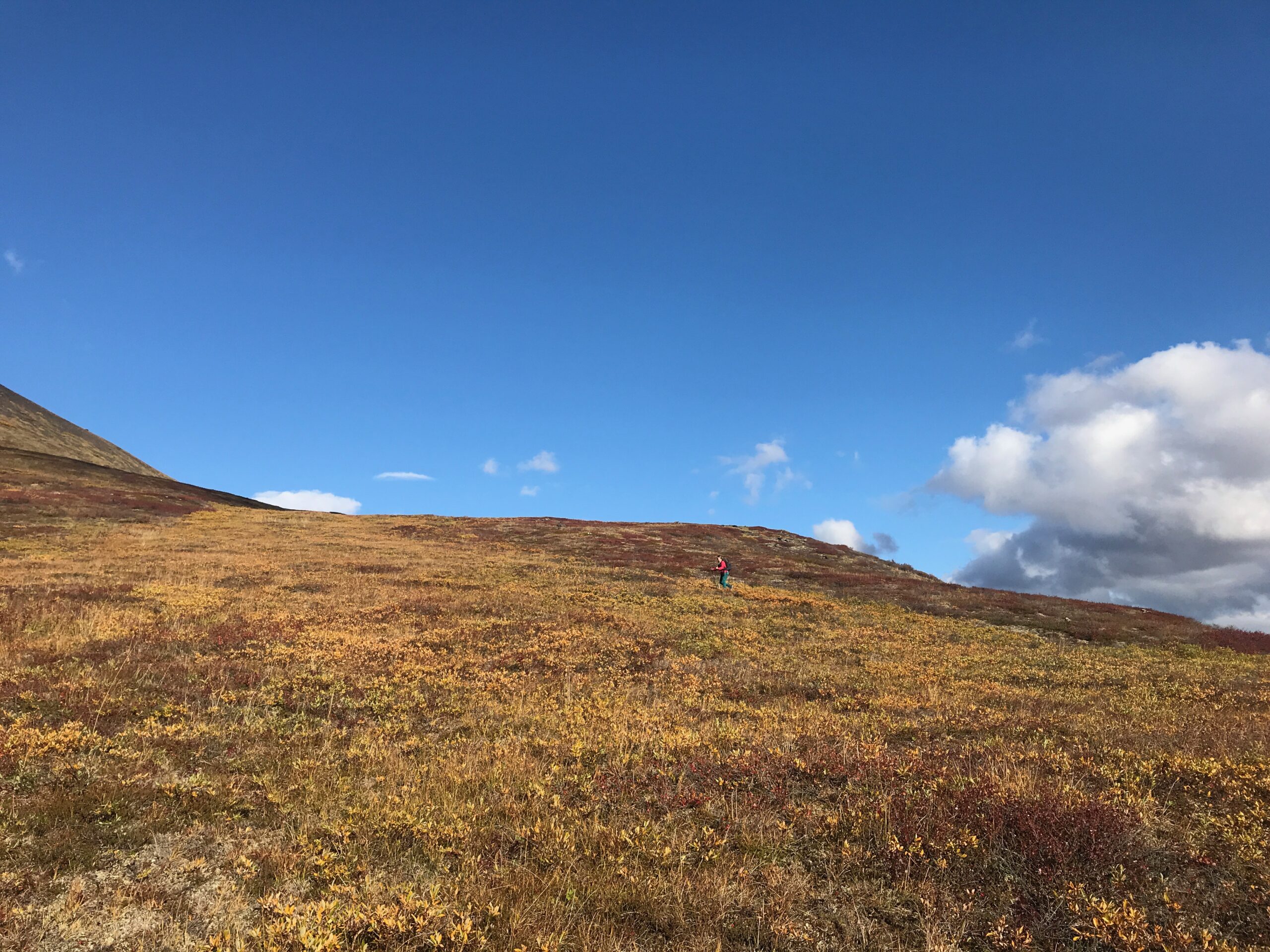
Besides driving and camping, we did lots of hiking, of course.
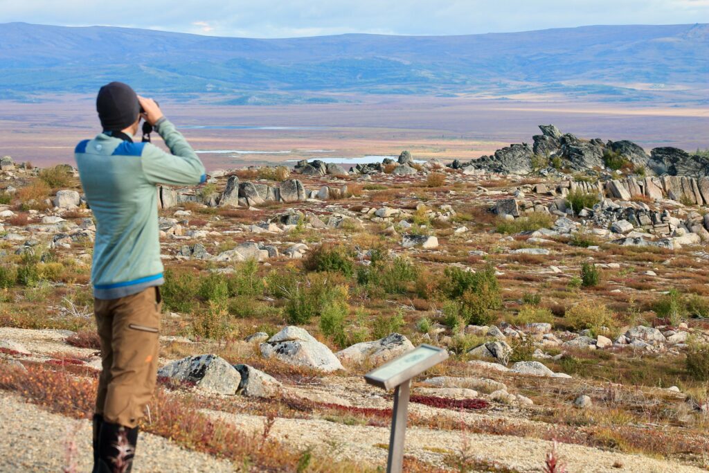
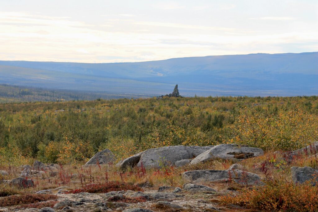
There’s a nice 1/2 mile interpretive trail at the Finger Mountain BLM Wayside, with good views of all interesting rock formations called “tors,” including “Finger Rock,” which points south toward Fairbanks.
We also did a 2-mile hike around Marion Creek at the campground.

But one of our other goals of this drive was to scout out Gates of the Arctic National Park and Preserve. I use the term “scout out” lightly because the park encompasses 8.4 million acres (roughly the size of Massachusetts and Connecticut). Like many other parks in Alaska, it’s trail-less and there are very few access points. Most people hire a bush plane to be dropped in the middle of nowhere, or paddle the rivers, so orienteering skills are a must.
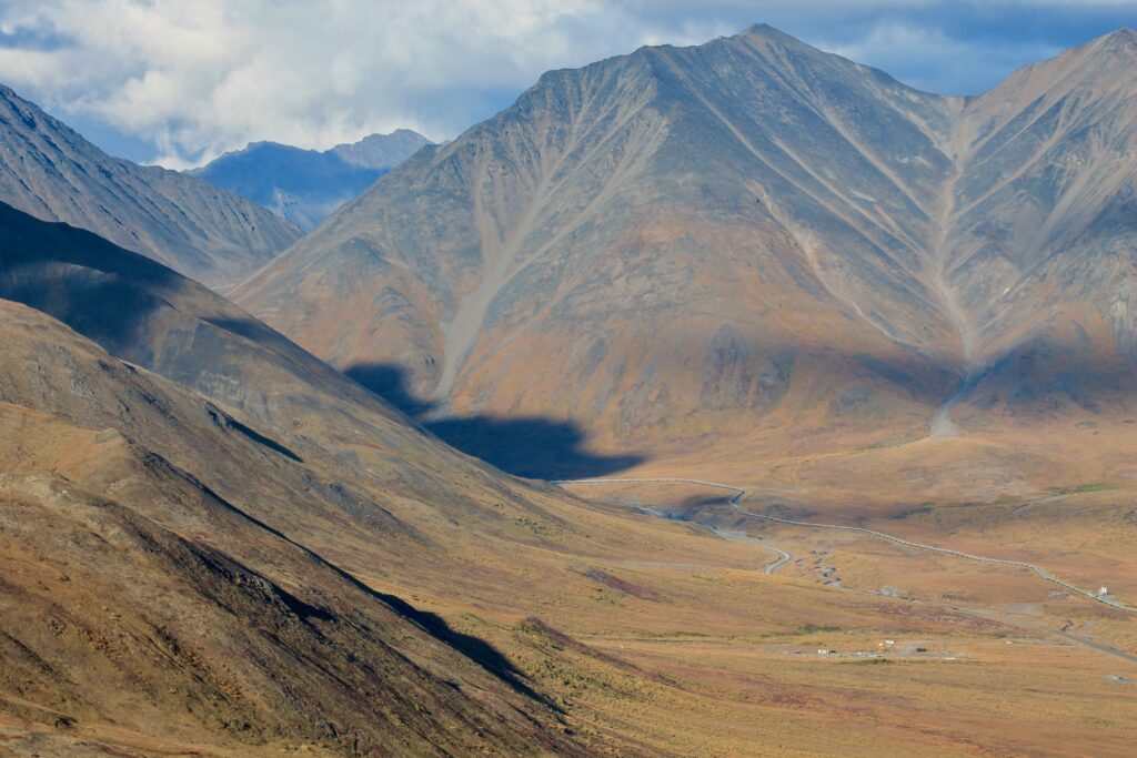
Over the years, I vaguely heard of people “hiking into the park” from the Atigun Pass area of Dalton Highway. Probably the closest point to “step” over the boundary of the park is 2 miles (over trail-less tussock grass and wet tundra). So theoretically, we could checked the park off our list. But after talking to rangers a bit more, that’s not how we wanted to experience the park. We would love to fly over the actual “gates” (the precipitous peaks of Frigid Crags and Boreal Mountain on either side of the Koyukuk River). We would love to explore the area of Arrigetch Peaks, Oolah Pass and Anaktuvuk Pass . We would love to visit the village of Anaktuvak or Bettles. I mean, with all that acreage, the possibilities of exploration are endless.
We did a 3-mile hike around Chandalar Shelf (one of the loosely known access points), and you could say we got a look “into” Gates of the Arctic National Park. The consensus is: we need more time, research and apparently money (for the bush flights and potentially guides).
So driving the Dalton Highway might be a “one and done” type of trip, but it was worthwhile to us.


Y’all are who I wanted to be as a kid. I think my folx took a bus tour where you drove ans it slid ofr the road a lil. He mentioned in story Prudo Bay, ValDez and Ketchican. He loved it up there. Have a great everything
Beautiful pictures of the pretty fall colors! Sounds like it was an exciting adventure!
Ah, so jealous! I would love to drive that road, even if it is a one and done! isn’t Gates of the Arctic one of the least visited NPs? Or maybe THE lease visited?
Some of your photos are very Backpacker mag worthy!
I’m just catching up on your summer, and wow, it is gorgeous up there!